Why Carlsbad’s McClellan-Palomar Airport appears on the FAA national hot spots list for runway-surface safety
McClellan-Palomar is listed for specific ground-movement risk areas, not as a ranking of overall airport safety
McClellan-Palomar Airport in Carlsbad, operated by San Diego County, appears on a federal aviation “hot spots” list that flags specific locations on an airport’s movement area where the risk of surface conflict is elevated. The designation is tied to defined points—typically intersections of runways and taxiways—where pilots and vehicle drivers are expected to apply heightened vigilance.
In federal charting, a “hot spot” is defined as a location on an airport movement area with a history of, or potential for, collision risk or runway incursions. These areas are depicted on official airport diagrams with numbered identifiers (such as HS 1 or HS 2) and are accompanied by short descriptions intended to support preflight briefings and real-time situational awareness during taxi, takeoff, and landing operations.
Two hot spots are identified at McClellan-Palomar, each describing a different operational hazard
McClellan-Palomar’s listing includes two hot spots, each tied to a particular risk type:
HS 1: Large jets may obscure the control tower’s visibility of smaller aircraft.
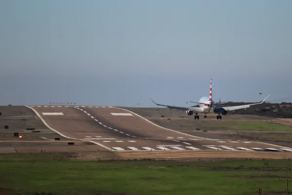
HS 2: A caution area associated with exiting Runway 24 at Taxiway A4.
While the hot spot descriptions are brief, their practical meaning is straightforward: the risks arise from geometry, sight lines, and the sequencing of aircraft on the ground. At airports where business jets and smaller general aviation aircraft share a runway and taxiway system, tower line-of-sight limitations can become a hazard if an aircraft is difficult to see from the tower cab at particular positions. Likewise, runway exit points can become conflict-prone when aircraft clear the runway, cross taxiways, or transition into ramp areas in ways that can be misinterpreted or missed during busy periods.
How hot spots function inside the national runway-safety framework
Hot spot identification is part of a broader runway-safety approach that uses data and local operational knowledge to reduce the likelihood of runway incursions and surface incidents. Hot spots are not punitive labels and do not, by themselves, indicate that an airport is unsafe to use. Instead, they are intended as targeted risk communications—one layer of safety information alongside air traffic control instructions, airfield signage and markings, lighting systems, and published procedures.
Hot spot charting is designed to prompt extra attention during surface operations at known or plausible conflict points.
What changes for pilots, operators, and the public
For flight crews, the immediate impact is procedural: incorporate the hot spot notes into pre-taxi briefings, verify clearances carefully, and anticipate the specific risk described (such as limited visibility of small aircraft near larger jets). For airport operators, persistent hot spots can inform training, signage, marking enhancements, and local coordination efforts aimed at reducing confusion at the identified locations.
For residents, the listing does not automatically correspond to flight volume, noise levels, or expansion plans. It is primarily a safety-communication tool focused on ground movement where aircraft and authorized vehicles share controlled areas.