Morning Mist and Midnight Showers: San Diego Braces for a Gray Wednesday
Commuter Alert: Dense Fog Blankets the Region
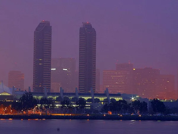
San Diegans waking up this Wednesday, January 21, 2026, are greeted by a thick blanket of marine layer as a Dense Fog Advisory takes center stage. According to the National Weather Service, the advisory remains in effect until 9:00 a.m. PST, covering coastal areas and inland valleys. Commuters are urged to exercise extreme caution as visibility has dropped to one-quarter mile or less in many sectors. The NWS recommends slowing down and using low-beam headlights to navigate the hazardous conditions.
Morning Forecast: A Slow Burn-Off
The early morning hours will be defined by low visibility and high humidity, currently hovering near 90%. As the fog slowly lifts throughout the mid-morning, it will give way to overcast skies rather than the typical Southern California sunshine. Residents should expect a cool start to the day with temperatures starting in the low 50s. While the sun may attempt a brief appearance around noon, the cloud cover is expected to remain stubborn for most of the coastal and mesa communities.
Afternoon Outlook: Cloudy and Cool
By midday, the region will remain mostly cloudy as a weak low-pressure system begins to develop off the coast. The afternoon high is expected to reach approximately 64°F, marking a noticeable cooldown compared to earlier in the week. Onshore winds will remain light and variable, eventually shifting to a steady breeze from the south by late afternoon. This shift marks the arrival of a broader weather system that will dominate the local climate for the next 48 hours.
- High Temperature: 64°F
- Humidity: 45% - 50% during peak hours
- Wind: Light and variable, 5-8 mph
Evening and Nighttime Predictions: Rain on the Horizon
As we transition into the evening, the cloud cover will thicken significantly. While the daytime rain probability remains a low 10%, that figure jumps to 35% after sunset. Meteorologists are tracking light, scattered showers that are likely to move in late Wednesday night and persist into early Thursday morning. Although heavy downpours are not expected, the damp roads could make for a slick late-night commute.
- Evening Low: 52°F
- Rain Probability: 35% after 9:00 p.m.
- Conditions: Overcast with intermittent light drizzle.
Looking ahead, this cooling trend is expected to persist through the end of the week. Temperatures will continue to dip, with more consistent light rain forecasted for Thursday and Friday. For now, residents are advised to keep their umbrellas handy for the evening and stay vigilant during the foggy morning hours.